Khumbu · Challenging
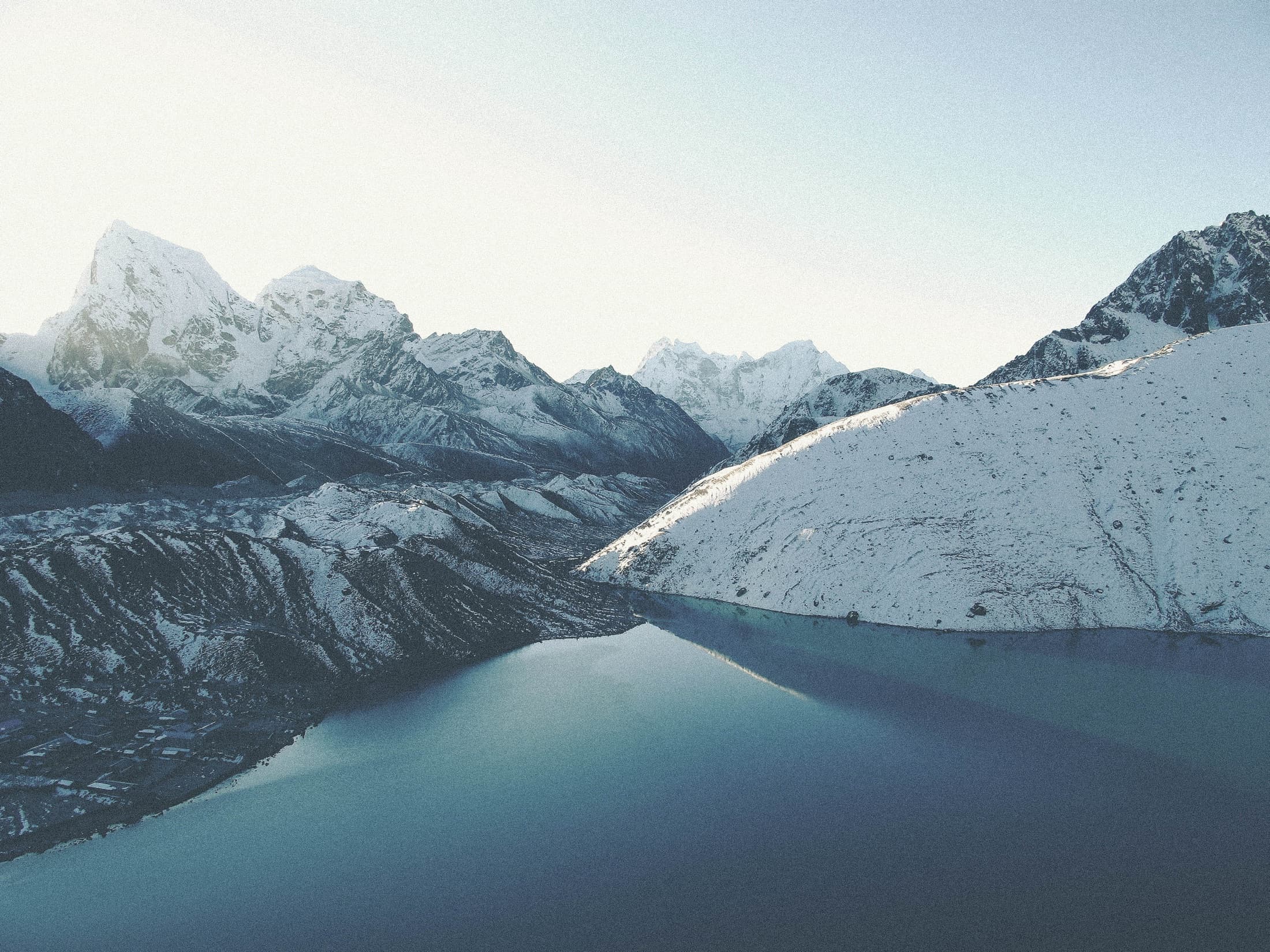
Gokyo Lakes & Renjo La
The Everest alternative for travelers who want fewer crowds, mirrored lakes, and elite photo moments.
Route planning map
Explore the route before you commit to it.
Switch between topographic context, overall route shape, and stage-by-stage stops so you can see how the trek unfolds in real terms, not just as a line between famous names.
Route map
Gokyo Lakes & Renjo La
Loading route map
Drawing the topographic base, route line, and stage markers for this itinerary.
Route read
Namche Bazaar to Renjo La
A more elegant Khumbu arc with lakes, high pass geometry, and fewer crowds than the base camp line. Destination focus: Renjo La at 5,360m, a high pass with broad Everest-region views and a memorable descent.
Route progress
0 km
Completed
~22 km
Total route
Elevation profile
↑ 2,270 m
Elevation gain
↓ 3,120 m
Max elevation
Current leg
Namche Bazaar to Dole
Est. distance
Stage type
Duration
14 days
Max altitude
5,360m
Best seasons
Mar-May · Oct-Nov
Starting rate
$2,490+
Permits and access
Permits
Sagarmatha National Park, Khumbu Pasang Lhamu fee
Access
Kathmandu-Lukla flight, Optional heli return
Stay style
Kathmandu design hotel + high-comfort teahouses
Customize your trip
helicopter
Private heli return from Gokyo or nearby zones when weather permits.